Exploring Lake Havasu


By Becky Maxedon
Prime hiking season is arriving in the Lake Havasu City area and there are plenty of trails for all levels of hiking experience and skill.
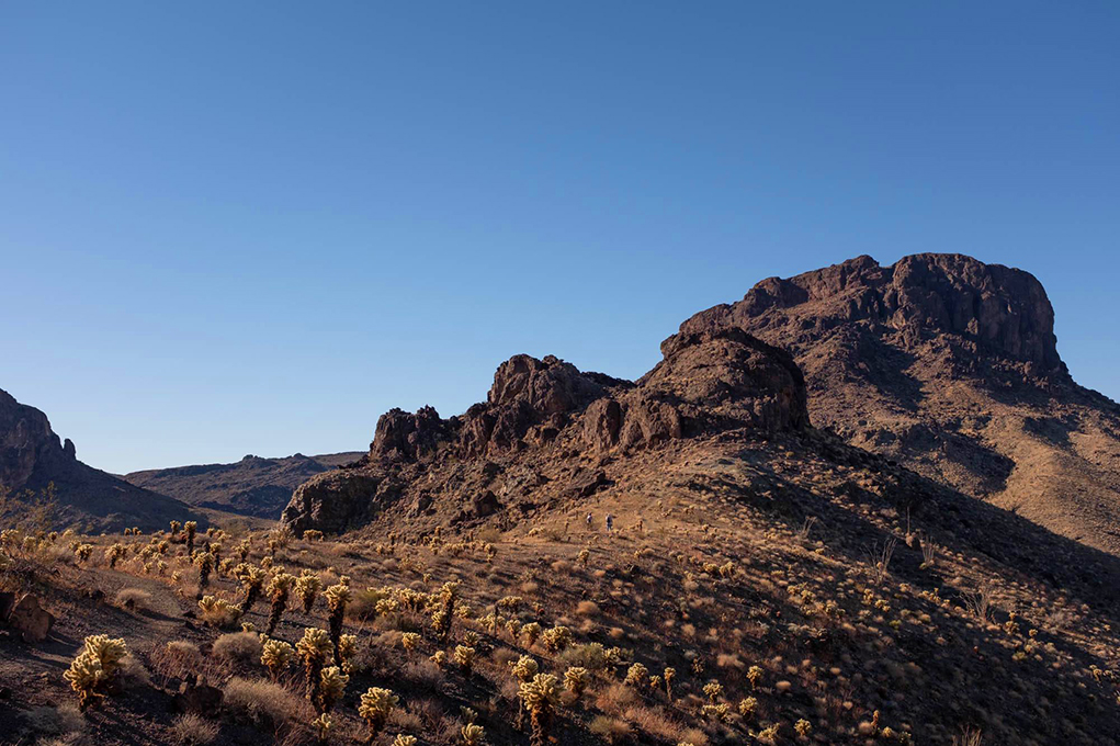
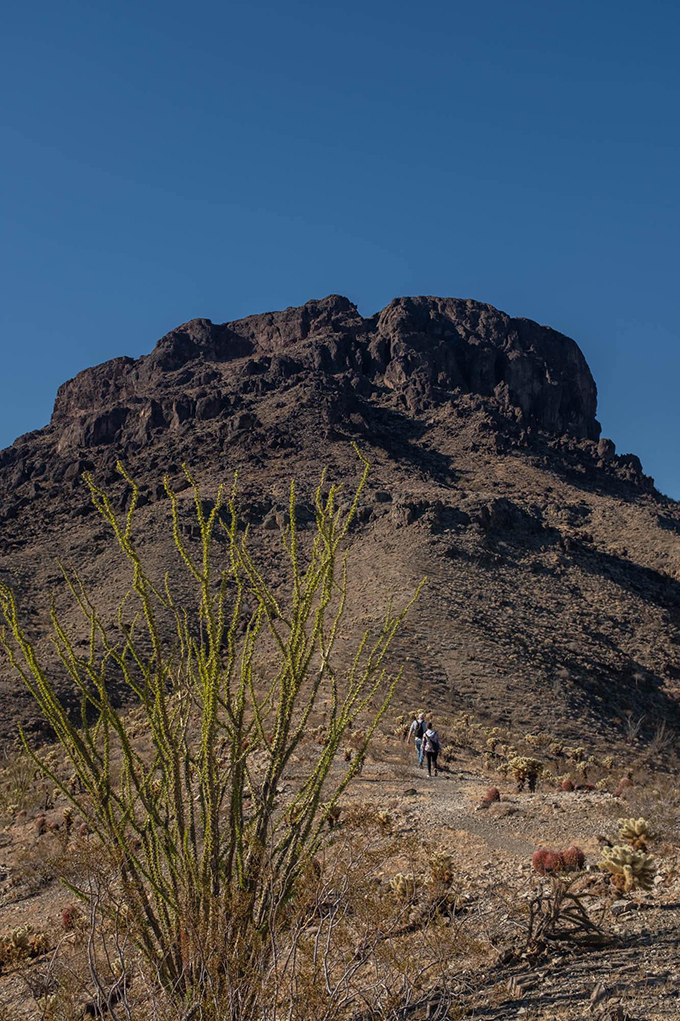
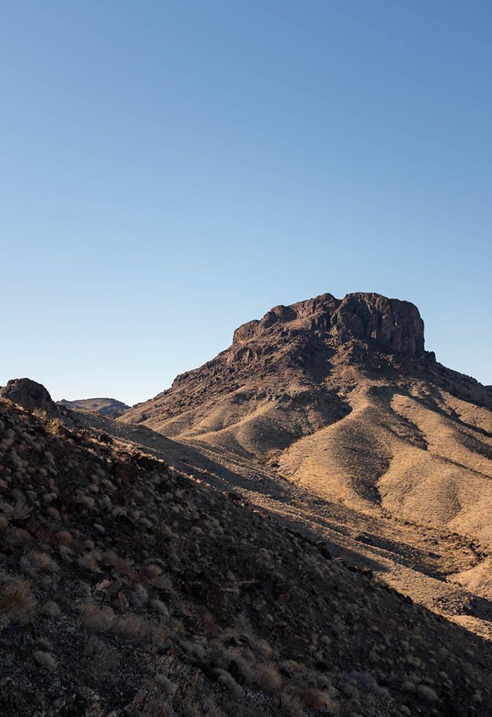
One of the iconic Lake Havasu landmarks is Cupcake Mountain. And its hiking trail is one of the more challenging.
The Bureau of Land Management website says this about the landmark. “Cupcake Mountain provides a towering presence from its vantage point southwest of Lake Havasu City, Arizona. The mountain was named by the Army Corps of Engineers in the early 1940s while they were building an airport and runway in the desert prior to the town being incorporated. The trailhead is located just off a powerline access road along the border of the Whipple Mountains Wilderness area. The mountain itself is within the wilderness area. The hike is rather strenuous and is close to 5 miles long round trip.”
The Cupcake Mountain Trail was established in 1986 by Tim O’Connor, according to golakehavasu.com.
Local Havasu hiker Robert Smith hiked Cupcake Mountain recently.
“The hike was very scenic and rewarding. The scenery during the hike almost matches the view at the end. It is definitely a difficult hike. It is not long, but the elevation you gain during the hike probably makes it one of the more challenging hikes in the Havasu area. It is not a hike for beginners. That being said, it should be on any hiker’s to-do list,” Smith said.
He said the drive to get to Cupcake mountain took about an hour and a half.
According to both the BLM website and golakehavasu.com, there are two ways to reach the trailhead.
The trip from Lake Havasu City south toward Parker, is probably the most expedient.
Take State Route 95 south from Lake Havasu City. Drive over Parker Dam to the Metropolitan Water District road. Head west on the road marked to Black Meadow Landing. Drive approximately 6 miles to a dirt road on the left heading towards Havasu Palms.
In 2 miles, the road to Havasu Palms veers right. Turn left on a private road following the main electrical towers for about another 6.5 miles. The road is occasionally maintained and may be rough. A 4-wheel drive high clearance vehicle is recommended. Use caution. Look for the electrical tower on the right with a small straight road leading to it. It is situated just across from the end of the mountain block on the right, overlooking a clearing with a view of Lake Havasu City. Make sure it is tower #50-G-1 or proceed to the next one. Park here. Walk back about 50 yards on the road in the direction you came from. A rock cairn marks the start of the trail up Cupcake Mountain (elev 2878 ft), which is not in view until you hike around the first mountain called Indian Nose at approximately the halfway point.
The other route begins in Needles, Calif. Take U.S. Highway 95 south approximately 45 miles to CA State Highway 62. Turn left on Hwy 62 and drive east approx. 16 miles to Earp, Calif. At the stop sign in Earp, drive straight onto Parker Dam Road. Follow this road approx. 13 miles to MWD Road (just south of the Parker Dam). Turn left onto MWD road and follow it approximately 5 miles to a fork in the road. Turn left onto BLM Route NS056 – Powerline Road. Stay on the powerline road for approx. 6 miles. Turn right onto a pullout for a powerline tower and park. The trailhead will be on the west side of BLM Route NS056.
The difficulty of the hike is categorized as strenuous, with long steep slopes. The last half mile requires scrambling up loose rock on a very steep grade; this can be potentially dangerous and life-threatening if you are not extremely careful.
Trailhead location: Tower # 50-G-1 (elev 1170 ft). Maximum three car parking allowed. Do not block other vehicles. You must allow official vehicle access to the power lines at all times.
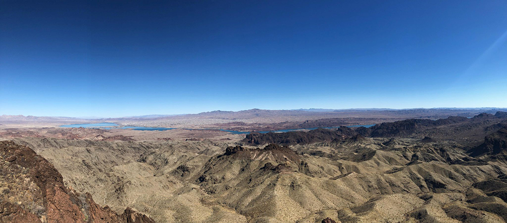
This signature hike offers spectacular views from atop an iconic mountain that provides Lake Havasu’s most famous natural photographic backdrop. The trail is for experienced hikers only. Groups of 10 or more require a permit from the Bureau of Land Management.
Start up the trail and walk uphill for about 1.4 miles to a flat area in the shade on the north side of a mountain (elev 2,060 ft). Cupcake Mountain now comes into view. The trail curves left through a scenic cactus field and up to another flat area (elev 2,310 ft) called the Pink Spot. From here to the top is all uphill, loose rock, and steep. The trail is not well defined. Follow rock cairns. The last section involves a short descent into a slot, crossing a short ledge, and a steep climb to the summit. Hikers have to come back down the same way. Commercial operators are not allowed on Cupcake Mountain.
Destination GPS coordinates: 34.346134, -114.325006
Trailhead GPS coordinates: 34.404696, -114.311678
Vehicle required: 4-wheel

Keep it helpful, local, and respectful.
Good Evening,
I visited Lake Havsau for the first time and fell in love with the view.I wanted to find the closet waterfall in Arizona by hiking or car.Can you please give me information.
Thank You