


Vegas National Weather Service updated press release as of Sunday morning. RiverScene will update again if anything changes.
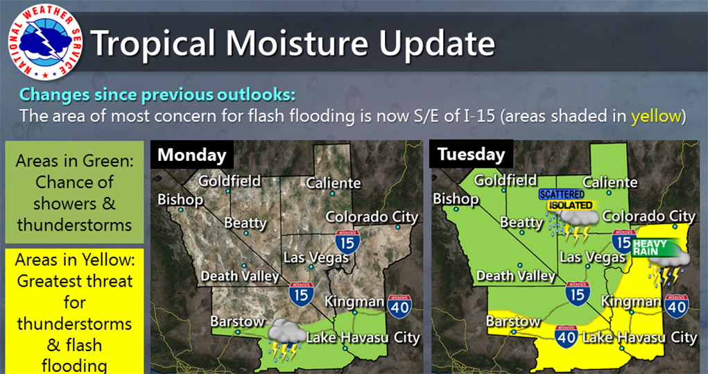
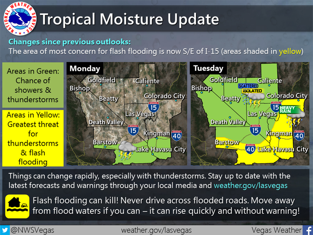
Several models starting to suggest heaviest area of rain may move further east across central Arizona grazing Mohave County Monday night through Tuesday night.
Others still showing potential further west for parts of San Bernardino, Clark and Lincoln Counties.
OVERVIEW:
Computer model differences leading to greater uncertainty in eventual areas which may experience the heaviest rainfall. The best window for rainfall still appears to be Monday night through Tuesday night. A combination of deep tropical moisture and a closed low pressure system moving inland across southern California is the best type of pattern for widespread rainfall for the Mojave Desert region. Isolated embedded thunderstorms may develop which could bring localized very heavy rainfall for some spots.
WEATHER IMPACTS
Mohave County
· Has the best potential for widespread showers with embedded thunderstorms Monday night through Tuesday night. Heavy rainfall and flash flooding possible.
Confidence MODERATE
San Bernardino/Clark/Lincoln Counties
· These counties will see the potential for scattered showers with embedded thunderstorms Monday night through Tuesday night. Localized heavy rainfall and flash flooding possible.
Confidence LOW-MODERATE
Inyo/Esmeralda/Southern and Central Nye Counties
· These counties may see some a few showers or thunderstorms, but the more substantial moisture is currently expected to remain over areas to the south and east. – Confidence HIGH

Leave a Comment
Keep it helpful, local, and respectful.